![[Translate to English:]](/storages/rst-etit/_processed_/e/8/csm_Technologie_RST_2018_339_4acb56a732.jpg "[Translate to English:]")
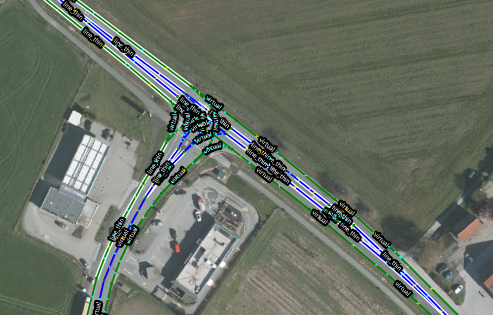
Localization in aerial maps of the rural region
For the use case of localizing an automated vehicle on a map, the exclusive use of a GNS system is usually not sufficient. Instead, the use of exteroceptive sensors, which perceive landmarks in their environment in order to localize the vehicle relative to its surroundings, is used.
The use of such methods requires an exact metric determination of the relative position of these landmarks. Current methods often use lidar sensors for this purpose, as these are able to precisely determine the spatial position of their measuring points.
The use of radar sensors in combination with cameras is a cost-effective alternative, as this combination allows both high-resolution environment detection and precise metric distance measurement. The usual method for creating HD maps is disproportionately expensive in rural areas due to the lower population density. This suggests alternative methods for creating maps that do not require mapping trips with vehicles on the ground.
Digital orthophotos (DOP) are required for various surveying and administrative tasks and are therefore already available nationwide. This data source can be used for automated driving in different ways.
The LegendäR project therefore aims to develop methods that enable egolocalization and the extraction of relevant semantic information from aerial images.
The focus is on the challenges that arise from the different perspectives.
For example, parts of the environment that are visible to the vehicle may be obscured in the aerial image or vice versa.
Structural changes can also drastically alter the real conditions compared to the aerial image.
These situations must be recognized and the resulting uncertainties quantified in order to provide downstream components of the processing chain with a model of the environment that is as reliable as possible.